
Hawaii Flood Hazard Zones
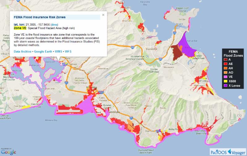 click on photograph to enlarge
The latest effective flood hazard zones from the Federal Emergency Management Agency (FEMA) Flood Insurance Rate Maps (FIRM) for the State of Hawaiʻi are now updated in PacIOOS Voyager. FIRM indicate the potential for flooding in any given year and are vital to plan for future events in a manner that increases resiliency. Go to http://ow.ly/riJxi
This information came from the Pacific Islands Ocean Observing System (PacIOOS) website


Comments are closed.